
Morgan, Utah
Morgan, Utah | |
|---|---|
 Morgan's Old Commercial Street, March 2008 | |
 Location in Morgan County and the state of Utah | |
| Coordinates: 41°2′28″N 111°40′34″W / 41.04111°N 111.67611°W | |
| Country | |
| State | |
| County | Morgan |
| Settled | 1860 |
| Named after | Jedediah Morgan Grant |
| Government | |
| • Mayor | Steve Gale |
| Area | |
• Total | 2.96 sq mi (7.68 km2) |
| • Land | 2.96 sq mi (7.68 km2) |
| • Water | 0.00 sq mi (0.00 km2) |
| Elevation | 5,069 ft (1,545 m) |
| Population (2020) | |
• Total | 4,071 |
| • Density | 1,441.63/sq mi (556.59/km2) |
| Time zone | UTC−7 (Mountain (MST)) |
| • Summer (DST) | UTC−6 (MDT) |
| ZIP code | 84050 |
| Area code(s) | 385, 801 |
| FIPS code | 49-51910[3] |
| GNIS feature ID | 1430488[2] |
| Website | Official website |
Morgan is a city in the U.S. state of Utah and the county seat of Morgan County. It is part of the Ogden-Clearfield metropolitan area. It is named after Jedediah Morgan Grant, a leader in the Church of Jesus Christ of Latter-day Saints who served as an apostle and as a member of the LDS First Presidency under Brigham Young in the mid-1850s. As of the 2020 census, the city population was 4,071 people. Morgan is also a location where some of the movie Troll 2 was filmed in 1989.
History
[edit]Morgan's history dates back to around 1861, when North Morgan was settled (it was originally called Mount Joy.)[5] The community was named for Jedediah Morgan Grant, an apostle for The Church of Jesus Christ of Latter Day Saints, who helped settle the Morgan Valley and build the first road through Weber Canyon.[6] Eventually, in 1868, the settlements of North Morgan and South Morgan were combined to form the only incorporated city in Morgan County. When the Union Pacific Railroad built tracks through Weber Canyon in 1868-1869, it put Morgan on the map. At one point, it was said Morgan was the "only incorporated city on the Union Pacific line between Ogden and Omaha, Nebraska."[7]
Although Morgan's business district was initially located in South Morgan, when the railroad was built, local businessmen saw an opportunity to take business closer to railroad freight and passenger stations. Commercial Street became Morgan's center of commerce, as many of Morgan's establishments were moved to the west side of the railroad.[8] Commercial Street continues to serve as Morgan's main street and is the focal point of the Morgan Historic District. Early businesses along Commercial Street included a ZCMI store, J.C. Penney, and the First National Bank of Morgan.[9]
Geography
[edit]According to the United States Census Bureau, the city has a total area of 3.2 square miles (8.3 km2), all land. It has a humid continental climate with warm summers (Köppen Dfb). The city is located within Morgan Valley.
Climate
[edit]| Climate data for Morgan, Utah (1981–2010) | |||||||||||||
|---|---|---|---|---|---|---|---|---|---|---|---|---|---|
| Month | Jan | Feb | Mar | Apr | May | Jun | Jul | Aug | Sep | Oct | Nov | Dec | Year |
| Mean daily maximum °F (°C) | 35.8 (2.1) |
40.8 (4.9) |
51.8 (11.0) |
60.8 (16.0) |
70.6 (21.4) |
81.2 (27.3) |
90.6 (32.6) |
89.0 (31.7) |
78.4 (25.8) |
65.1 (18.4) |
48.1 (8.9) |
35.9 (2.2) |
62.3 (16.8) |
| Mean daily minimum °F (°C) | 13.3 (−10.4) |
16.6 (−8.6) |
25.4 (−3.7) |
31.7 (−0.2) |
38.4 (3.6) |
45.1 (7.3) |
52.1 (11.2) |
50.5 (10.3) |
40.7 (4.8) |
31.3 (−0.4) |
23.0 (−5.0) |
13.8 (−10.1) |
31.8 (−0.1) |
| Average precipitation inches (mm) | 1.53 (39) |
1.57 (40) |
1.69 (43) |
1.66 (42) |
1.86 (47) |
1.27 (32) |
0.65 (17) |
0.76 (19) |
1.45 (37) |
1.61 (41) |
1.79 (45) |
1.78 (45) |
17.61 (447) |
| Average snowfall inches (cm) | 15.4 (39) |
12.5 (32) |
6.3 (16) |
2.4 (6.1) |
0.4 (1.0) |
0.0 (0.0) |
0.0 (0.0) |
0.0 (0.0) |
0.2 (0.51) |
1.1 (2.8) |
8.6 (22) |
13.6 (35) |
60.3 (153) |
| Source: NOAA[10] | |||||||||||||
Demographics
[edit]| Census | Pop. | Note | %± |
|---|---|---|---|
| 1870 | 1,972 | — | |
| 1880 | 582 | −70.5% | |
| 1890 | 333 | −42.8% | |
| 1900 | 600 | 80.2% | |
| 1910 | 756 | 26.0% | |
| 1920 | 995 | 31.6% | |
| 1930 | 953 | −4.2% | |
| 1940 | 1,078 | 13.1% | |
| 1950 | 1,064 | −1.3% | |
| 1960 | 1,299 | 22.1% | |
| 1970 | 1,586 | 22.1% | |
| 1980 | 1,896 | 19.5% | |
| 1990 | 2,023 | 6.7% | |
| 2000 | 2,635 | 30.3% | |
| 2010 | 3,687 | 39.9% | |
| 2020 | 4,071 | 10.4% | |
| U.S. Decennial Census[11] | |||
As of the census[3] of 2000, there were 2,635 people, 789 households, and 665 families residing in the city. The population density was 823.8 people per square mile (317.9/km2). There were 822 housing units at an average density of 257.0 per square mile (99.2/km2). The racial makeup of the city was 99.09% White, 0.04% African American, 0.04% Native American, 0.08% Asian, 0.30% from other races, and 0.46% from two or more races. Hispanic or Latino of any race were 0.95% of the population. There were 789 households, out of which 49.9% had children under the age of 18 living with them, 75.2% were married couples living together, 7.1% had a female householder with no husband present, and 15.6% were non-families. 15.0% of all households were made up of individuals, and 8.9% had someone living alone who was 65 years of age or older. The average household size was 3.34 and the average family size was 3.74.
In the city, the population was spread out, with 37.2% under the age of 18, 10.1% from 18 to 24, 25.1% from 25 to 44, 16.8% from 45 to 64, and 10.7% who were 65 years of age or older. The median age was 27 years. For every 100 females, there were 99.2 males. For every 100 females age 18 and over, there were 93.0 males.
The median income for a household in the city was $47,716, and the median income for a family was $53,125. Males had a median income of $42,143 versus $23,011 for females. The per capita income for the city was $16,260. About 2.0% of families and 3.4% of the population were below the poverty line, including 2.6% of those under age 18 and 3.4% of those age 65 or over.
See also
[edit]- List of cities and towns in Utah
- Browning Arms Company, headquartered in the nearby unincorporated community of Mountain Green.
References
[edit]- ^ "2019 U.S. Gazetteer Files". United States Census Bureau. Retrieved August 7, 2020.
- ^ a b U.S. Geological Survey Geographic Names Information System: Morgan, Utah
- ^ a b "U.S. Census website". United States Census Bureau. Retrieved January 31, 2008.
- ^ "Population and Housing Unit Estimates". United States Census Bureau. May 24, 2020. Retrieved May 27, 2020.
- ^ "Morgan City | History to Go". historytogo.utah.gov. Retrieved April 27, 2025.
- ^ "Utah History Encyclopedia". www.uen.org. Retrieved April 27, 2025.
- ^ "History". Morgan County. Retrieved April 27, 2025.
- ^ "Morgan City | History to Go". historytogo.utah.gov. Retrieved April 27, 2025.
- ^ "DUP Happenings | The Morgan News". www.themorgannews.com. Retrieved April 27, 2025.
- ^ "NOWData - NOAA Online Weather Data". National Oceanic and Atmospheric Administration. Retrieved May 5, 2013.
- ^ "Census of Population and Housing". Census.gov. Retrieved June 4, 2015.
External links
[edit]Places adjacent to Morgan, Utah | |
|---|---|
Municipalities and communities of Morgan County, Utah, United States | ||
|---|---|---|
| City | 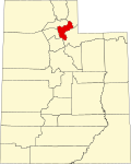 | |
| CDPs | ||
| Unincorporated communities | ||
| International | |
|---|---|
| National | |